Home » View more maps » 2010 Tour de France
2010 Tour de France - July 3-25, 2010 Prologue, STAGES 1-8
Prologue | Stage 1 | Stage 2 | Stage 3 | Stage 4 | Stage 5 | Stage 6 | Stage 7 | Stage 8
|
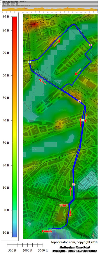
Tour de France Prologue (ITT) Stage winner: Fabian Cancellara (Saxo Bank) 5.53mi in 10:00(33.2mph) Saturday, July 3, 2010 |
|
 Print/Download |
|
Tour de France Stage 1 - Rotterdam to Brussells Stage winner: Alessandro Petacchi (Lampre) 153.7mi in 5:09:38(29.7mph) Sunday, July 4, 2010 |
|
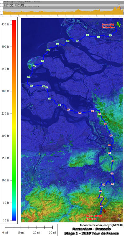 Tour de France Stage 1 |
|
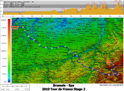
Tour de France Stage 2 - Brussells to Spa Stage winner: Sylvain Chavanel (Quick Step) Monday, July 5, 2010 |
|
 Print/Download |
 Tour de France Stage 2 - Brussells to Spa (3d) |
|
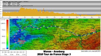
Tour de France Stage 3 - Wanze to Arenberg Stage winner: Thor Hushovd Cervelo Test Team in 4h 49' 38" Tuesday, July 6, 2010 |
|
 Print/Download |
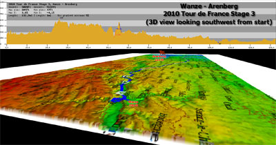 Tour de France Stage 3 - Wanze to Arenberg (3d) |
|
Tour de France Stage 4 - Cambrai to Reims Stage winner: Alessandro Petacchi Lampre Farnese in 3h 34' 55" Wednesday, July 7, 2010 |
|
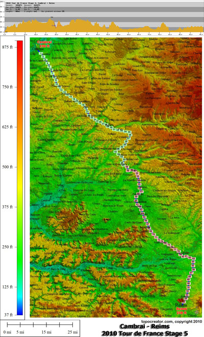 Print/Download |
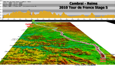 Tour de France Stage 4 - Cambrai to Reims (3d) |
|
Tour de France Stage 5 - Epernay to Montargis Stage winner: Mark Cavendish, Team HTC-Columbia in 4h 30' 50" Thursday, July 8, 2010 |
|
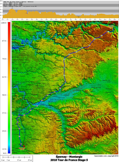 Print/Download |
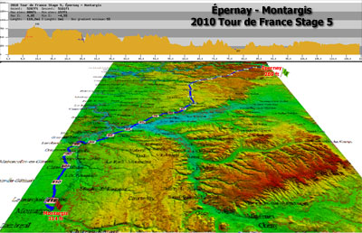 Tour de France Stage 5 - Epernay - Montargis (3d) |
|
Tour de France Stage 6 - Montargis to Gueugnon Stage winner: Mark Cavendish, Team HTC-Columbia in 5h 37' 42" Friday, July 9, 2010 |
|
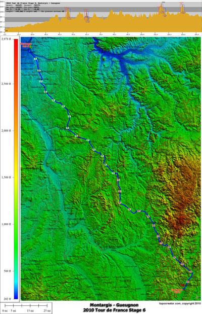 Print/Download |
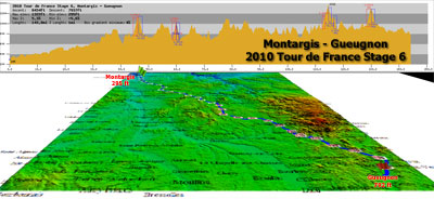 Tour de France Stage 6 - Montargis to Gueugnon (3d) |
|
Tour de France Stage 7 - Tournus to Station des Rousses Stage winner: Sylvain Chavanel Quick Step in 4h 22' 52" Saturday, July 10, 2010 |
|
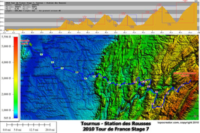 Print/Download |
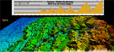 Tour de France Stage 7 - Tournus to Station des Rousses (3d) |
|
Tour de France Stage 8 - Station des Rousses to Avoriaz Stage winner: Andy Schleck, Team Saxo Bank in 4h 54' 11" Sunday, July 11, 2010 |
|
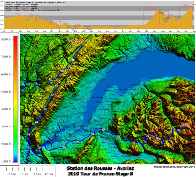 Print/Download |
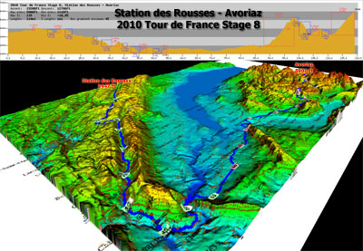 Tour de France Stage 8 - Station des Rousses to Avoriaz (3d) 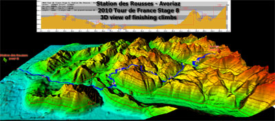 Tour de France Stage 8 - Station des Rousses to Avoriaz (3d finish) |
The beta version of topocreator.com is coming soon. Click the screenshot below for a preview!
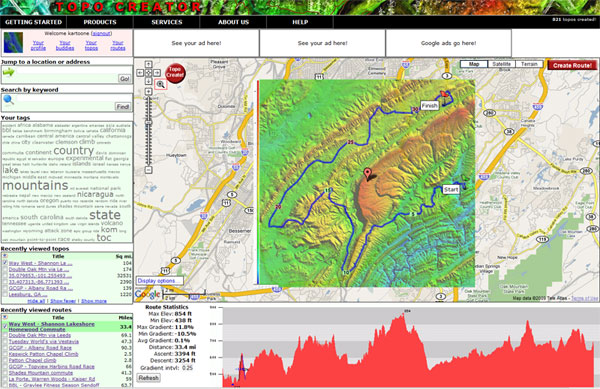
TERMS OF USE
All maps on this page have been created using the beta version of topocreator.com which is not available to the public yet. The tentative release date for the beta version of topocreator.com is August 2010. The elevation data used in the creation of these maps has been obtained through a variety of sources - the USGS, NOAA, NASA, and CIGAR. Vector street data has been licensed via Creative Commons Share-Alike through the OpenStreetMap project. All maps on this page are © topocreator.com and likewise released under the Creative Commons Share-Alike license.