Coming soon: Create your own topo maps!

TopoCreator

Customizable high-quality topographic maps

Home » State maps and elevation data

Terms of use. All maps displayed on this page or downloadable via a "download" link on this page are © 2009 topocreator.com released to the public under a Creative Commons Attribution-Share Alike license. Maps are available for purchase for a small fee for educational, personal, and commercial usage under an alternative license. The elevation data used in the creation of these maps has been obtained through the USGS, NOAA, and the US Census Bureau via the public domain.


Alaska (AK)
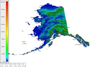
2,833,084 sq mi
Creative Commons License
Atlas Shading (with cities)
Medium resolution JPG 1399x1041:
Preview | Download FREE
High resolution JPG 1834x1349:
Watermarked Preview | Add to Cart $0.99
Ultra resolution JPG 4445x3196:
Watermarked Preview | Add to Cart $1.99
Download the National Elevation Dataset

Select one of the options below if you would like to download the elevation data used to create this map.

60m GMG (910.5 MB) Preview | Add to cart $24.99
View Cart | Checkout

Select another state or map style
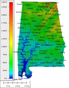
Alabama (AL)

75,032 sq mi
Creative Commons License
Atlas Shading (with cities)
Medium resolution JPG 624x794:
Preview | Download FREE
High resolution JPG 1665x2451:
Watermarked Preview | Add to Cart $0.99
Ultra resolution JPG 3920x6002:
Watermarked Preview | Add to Cart $1.99
Download the National Elevation Dataset

Select one of the options below if you would like to download the elevation data used to create this map.

30m GMG (254.1 MB) Preview | Add to cart $19.99
View Cart | Checkout

Select another state or map style
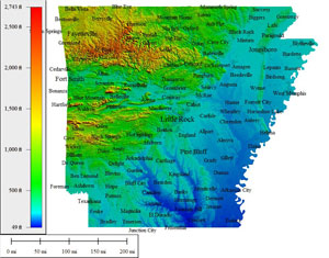
Arkansas (AR)

69,493 sq mi
Creative Commons License
Atlas Shading (with cities)
Medium resolution JPG 910x713:
Preview | Download FREE
High resolution JPG 2583x2138:
Watermarked Preview | Add to Cart $0.99
Ultra resolution JPG 6167x5191:
Watermarked Preview | Add to Cart $1.99
Download the National Elevation Dataset

Select one of the options below if you would like to download the elevation data used to create this map.

30m GMG (124.2 MB) Preview | Add to cart $14.99
View Cart | Checkout

Select another state or map style
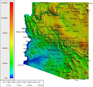
Arizona (AZ)

133,291 sq mi
Creative Commons License
Atlas Shading (with cities)
Medium resolution JPG 872x821:
Preview | Download FREE
High resolution JPG 2242x2500:
Watermarked Preview | Add to Cart $0.99
Ultra resolution JPG 5380x6119:
Watermarked Preview | Add to Cart $1.99
Download the National Elevation Dataset

Select one of the options below if you would like to download the elevation data used to create this map.

30m GMG (573.1 MB) Preview | Add to cart $19.99
View Cart | Checkout

Select another state or map style
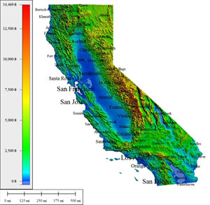
California (CA)

393,043 sq mi
Creative Commons License
Atlas Shading (with cities)
Medium resolution JPG 872x853:
Preview | Download FREE
High resolution JPG 2374x2609:
Watermarked Preview | Add to Cart $0.99
Ultra resolution JPG 5640x6378:
Watermarked Preview | Add to Cart $1.99
Download the National Elevation Dataset

Select one of the options below if you would like to download the elevation data used to create this map.

30m GMG (812.8 MB) Preview | Add to cart $24.99
View Cart | Checkout

Select another state or map style
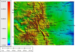
Colorado (CO)

118,740 sq mi
Creative Commons License
Atlas Shading (with cities)
Medium resolution JPG 957x645:
Preview | Download FREE
High resolution JPG 2712x1966:
Watermarked Preview | Add to Cart $0.99
Ultra resolution JPG 6476x4710:
Watermarked Preview | Add to Cart $1.99
Download the National Elevation Dataset

Select one of the options below if you would like to download the elevation data used to create this map.

30m GMG (294.4 MB) Preview | Add to cart $19.99
View Cart | Checkout

Select another state or map style
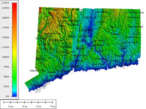
Connecticut (CT)

7,969 sq mi
Creative Commons License
Atlas Shading (with cities)
Medium resolution JPG 1011x755:
Preview | Download FREE
High resolution JPG 2868x2201:
Watermarked Preview | Add to Cart $0.99
Ultra resolution JPG 6848x5314:
Watermarked Preview | Add to Cart $1.99
Download the National Elevation Dataset

Select one of the options below if you would like to download the elevation data used to create this map.

30m GMG (14.5 MB) Preview | Add to cart $9.99
View Cart | Checkout

Select another state or map style
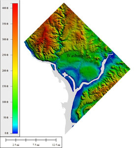
District of Columbia (DC)

167 sq mi
Creative Commons License
Atlas Shading (with cities)
Medium resolution JPG 790x865:
Preview | Download FREE
High resolution JPG 2243x2659:
Watermarked Preview | Add to Cart $0.99
Ultra resolution JPG 5355x6505:
Watermarked Preview | Add to Cart $1.99
Download the National Elevation Dataset

Select one of the options below if you would like to download the elevation data used to create this map.

30m GMG (209.5 KB) Preview | Add to cart $4.99
View Cart | Checkout

Select another state or map style
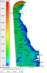
Delaware (DE)

5,045 sq mi
Creative Commons License
Atlas Shading (with cities)
Medium resolution JPG 559x864:
Preview | Download FREE
High resolution JPG 1213x2665:
Watermarked Preview | Add to Cart $0.99
Ultra resolution JPG 2828x6525:
Watermarked Preview | Add to Cart $1.99
Download the National Elevation Dataset

Select one of the options below if you would like to download the elevation data used to create this map.

30m GMG (3.8 MB) Preview | Add to cart $9.99
View Cart | Checkout

Select another state or map style
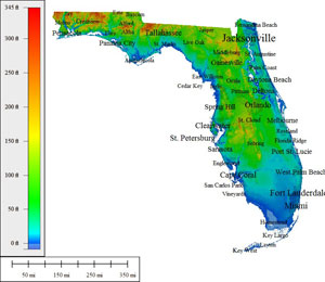
Florida (FL)

221,869 sq mi
Creative Commons License
Atlas Shading (with cities)
Medium resolution JPG 839x726:
Preview | Download FREE
High resolution JPG 2380x2248:
Watermarked Preview | Add to Cart $0.99
Ultra resolution JPG 5682x5467:
Watermarked Preview | Add to Cart $1.99
Download the National Elevation Dataset

Select one of the options below if you would like to download the elevation data used to create this map.

30m GMG (79.5 MB) Preview | Add to cart $19.99
View Cart | Checkout

Select another state or map style
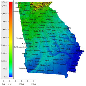
Georgia (GA)

92,786 sq mi
Creative Commons License
Atlas Shading (with cities)
Medium resolution JPG 800x799:
Preview | Download FREE
High resolution JPG 2217x2456:
Watermarked Preview | Add to Cart $0.99
Ultra resolution JPG 5294x6011:
Watermarked Preview | Add to Cart $1.99
Download the National Elevation Dataset

Select one of the options below if you would like to download the elevation data used to create this map.

30m GMG (133.7 MB) Preview | Add to cart $19.99
View Cart | Checkout

Select another state or map style
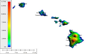
Hawaii (HI)

86,232 sq mi
Creative Commons License
Atlas Shading (with cities)
Medium resolution JPG 1019x646:
Preview | Download FREE
High resolution JPG 2289x1485:
Watermarked Preview | Add to Cart $0.99
Ultra resolution JPG 5466x3592:
Watermarked Preview | Add to Cart $1.99
Download the National Elevation Dataset

Select one of the options below if you would like to download the elevation data used to create this map.

10m GMG (106.2 MB) Preview | Add to cart $24.99
View Cart | Checkout

Select another state or map style
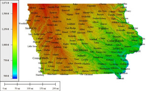
Iowa (IA)

75,412 sq mi
Creative Commons License
Atlas Shading (with cities)
Medium resolution JPG 1004x615:
Preview | Download FREE
High resolution JPG 2844x1873:
Watermarked Preview | Add to Cart $0.99
Ultra resolution JPG 6791x4405:
Watermarked Preview | Add to Cart $1.99
Download the National Elevation Dataset

Select one of the options below if you would like to download the elevation data used to create this map.

30m GMG (147.4 MB) Preview | Add to cart $19.99
View Cart | Checkout

Select another state or map style
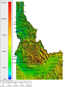
Idaho (ID)

154,028 sq mi
Creative Commons License
Atlas Shading (with cities)
Medium resolution JPG 719x955:
Preview | Download FREE
High resolution JPG 1933x2953:
Watermarked Preview | Add to Cart $0.99
Ultra resolution JPG 4612x7235:
Watermarked Preview | Add to Cart $1.99
Download the National Elevation Dataset

Select one of the options below if you would like to download the elevation data used to create this map.

30m GMG (278.9 MB) Preview | Add to cart $19.99
View Cart | Checkout

Select another state or map style
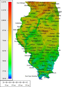
Illinois (IL)

95,503 sq mi
Creative Commons License
Atlas Shading (with cities)
Medium resolution JPG 635x870:
Preview | Download FREE
High resolution JPG 1674x2689:
Watermarked Preview | Add to Cart $0.99
Ultra resolution JPG 3941x6585:
Watermarked Preview | Add to Cart $1.99
Download the National Elevation Dataset

Select one of the options below if you would like to download the elevation data used to create this map.

30m GMG (128.9 MB) Preview | Add to cart $19.99
View Cart | Checkout

Select another state or map style
Indiana (IN)

57,317 sq mi
Creative Commons License
Atlas Shading (with cities)
Medium resolution JPG 740x871:
Preview | Download FREE
High resolution JPG 1842x2689:
Watermarked Preview | Add to Cart $0.99
Ultra resolution JPG 4361x6586:
Watermarked Preview | Add to Cart $1.99
Download the National Elevation Dataset

Select one of the options below if you would like to download the elevation data used to create this map.

30m GMG (88.5 MB) Preview | Add to cart $14.99
View Cart | Checkout

Select another state or map style
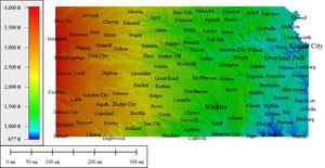
Kansas (KS)

85,498 sq mi
Creative Commons License
Atlas Shading (with cities)
Medium resolution JPG 956x495:
Preview | Download FREE
High resolution JPG 2712x1409:
Watermarked Preview | Add to Cart $0.99
Ultra resolution JPG 6476x3322:
Watermarked Preview | Add to Cart $1.99
Download the National Elevation Dataset

Select one of the options below if you would like to download the elevation data used to create this map.

30m GMG (195.8 MB) Preview | Add to cart $19.99
View Cart | Checkout

Select another state or map style
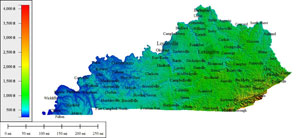
Kentucky (KY)

77,240 sq mi
Creative Commons License
Atlas Shading (with cities)
Medium resolution JPG 1199x550:
Preview | Download FREE
High resolution JPG 2695x1217:
Watermarked Preview | Add to Cart $0.99
Ultra resolution JPG 6434x2860:
Watermarked Preview | Add to Cart $1.99
Download the National Elevation Dataset

Select one of the options below if you would like to download the elevation data used to create this map.

30m GMG (122.3 MB) Preview | Add to cart $19.99
View Cart | Checkout

Select another state or map style
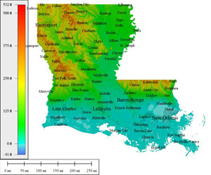
Louisiana (LA)

89,981 sq mi
Creative Commons License
Atlas Shading (with cities)
Medium resolution JPG 872x724:
Preview | Download FREE
High resolution JPG 2475x2164:
Watermarked Preview | Add to Cart $0.99
Ultra resolution JPG 5909x5268:
Watermarked Preview | Add to Cart $1.99
Download the National Elevation Dataset

Select one of the options below if you would like to download the elevation data used to create this map.

30m GMG (88.8 MB) Preview | Add to cart $19.99
View Cart | Checkout

Select another state or map style
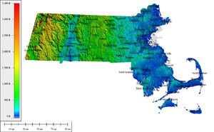
Massachussetts (MA)

22,149 sq mi
Creative Commons License
Atlas Shading (with cities)
Medium resolution JPG 1281x790:
Preview | Download FREE
High resolution JPG 2879x1757:
Watermarked Preview | Add to Cart $0.99
Ultra resolution JPG 6874x4202:
Watermarked Preview | Add to Cart $1.99
Download the National Elevation Dataset

Select one of the options below if you would like to download the elevation data used to create this map.

30m GMG (24 MB) Preview | Add to cart $9.99
View Cart | Checkout

Select another state or map style
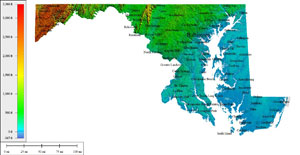
Maryland (MD)

30,920 sq mi
Creative Commons License
Atlas Shading (with cities)
Medium resolution JPG 1476x764:
Preview | Download FREE
High resolution JPG 2746x1412:
Watermarked Preview | Add to Cart $0.99
Ultra resolution JPG 6555x3356:
Watermarked Preview | Add to Cart $1.99
Download the National Elevation Dataset

Select one of the options below if you would like to download the elevation data used to create this map.

30m GMG (27.2 MB) Preview | Add to cart $9.99
View Cart | Checkout

Select another state or map style
Maine (ME)

65,426 sq mi
Creative Commons License
Atlas Shading (with cities)
Medium resolution JPG 757x950:
Preview | Download FREE
High resolution JPG 1997x2937:
Watermarked Preview | Add to Cart $0.99
Ultra resolution JPG 4748x7192:
Watermarked Preview | Add to Cart $1.99
Download the National Elevation Dataset

Select one of the options below if you would like to download the elevation data used to create this map.

30m GMG (152.3 MB) Preview | Add to cart $14.99
View Cart | Checkout

Select another state or map style
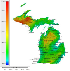
Michigan (MI)

197,037 sq mi
Creative Commons License
Atlas Shading (with cities)
Medium resolution JPG 958x972:
Preview | Download FREE
High resolution JPG 2660x2947:
Watermarked Preview | Add to Cart $0.99
Ultra resolution JPG 6392x7188:
Watermarked Preview | Add to Cart $1.99
Download the National Elevation Dataset

Select one of the options below if you would like to download the elevation data used to create this map.

30m GMG (210.9 MB) Preview | Add to cart $19.99
View Cart | Checkout

Select another state or map style
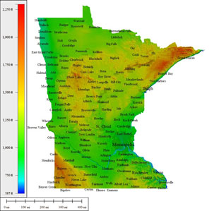
Minnesota (MN)

157,760 sq mi
Creative Commons License
Atlas Shading (with cities)
Medium resolution JPG 1006x1003:
Preview | Download FREE
High resolution JPG 2854x3035:
Watermarked Preview | Add to Cart $0.99
Ultra resolution JPG 6814x7389:
Watermarked Preview | Add to Cart $1.99
Download the National Elevation Dataset

Select one of the options below if you would like to download the elevation data used to create this map.

30m GMG (191 MB) Preview | Add to cart $19.99
View Cart | Checkout

Select another state or map style
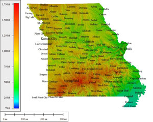
Missouri (MO)

120,485 sq mi
Creative Commons License
Atlas Shading (with cities)
Medium resolution JPG 944x755:
Preview | Download FREE
High resolution JPG 2678x2258:
Watermarked Preview | Add to Cart $0.99
Ultra resolution JPG 6393x5478:
Watermarked Preview | Add to Cart $1.99
Download the National Elevation Dataset

Select one of the options below if you would like to download the elevation data used to create this map.

30m GMG (188 MB) Preview | Add to cart $19.99
View Cart | Checkout

Select another state or map style
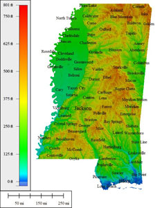
Mississippi (MS)

76,655 sq mi
Creative Commons License
Atlas Shading (with cities)
Medium resolution JPG 618x794:
Preview | Download FREE
High resolution JPG 1640x2452:
Watermarked Preview | Add to Cart $0.99
Ultra resolution JPG 3857x6003:
Watermarked Preview | Add to Cart $1.99
Download the National Elevation Dataset

Select one of the options below if you would like to download the elevation data used to create this map.

30m GMG (114.2 MB) Preview | Add to cart $19.99
View Cart | Checkout

Select another state or map style
Montana (MT)

218,830 sq mi
Creative Commons License
Atlas Shading (with cities)
Medium resolution JPG 1074x594:
Preview | Download FREE
High resolution JPG 3037x1707:
Watermarked Preview | Add to Cart $0.99
Ultra resolution JPG 7252x4052:
Watermarked Preview | Add to Cart $1.99
Download the National Elevation Dataset

Select one of the options below if you would like to download the elevation data used to create this map.

30m GMG (473 MB) Preview | Add to cart $19.99
View Cart | Checkout

Select another state or map style
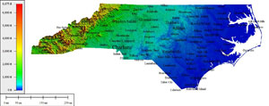
North Carolina (NC)

96,798 sq mi
Creative Commons License
Atlas Shading (with cities)
Medium resolution JPG 1402x558:
Preview | Download FREE
High resolution JPG 2608x1033:
Watermarked Preview | Add to Cart $0.99
Ultra resolution JPG 6228x2386:
Watermarked Preview | Add to Cart $1.99
Download the National Elevation Dataset

Select one of the options below if you would like to download the elevation data used to create this map.

30m GMG (123.9 MB) Preview | Add to cart $19.99
View Cart | Checkout

Select another state or map style
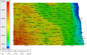
North Dakota (ND)

77,387 sq mi
Creative Commons License
Atlas Shading (with cities)
Medium resolution JPG 1098x695:
Preview | Download FREE
High resolution JPG 3115x1942:
Watermarked Preview | Add to Cart $0.99
Ultra resolution JPG 7438x4571:
Watermarked Preview | Add to Cart $1.99
Download the National Elevation Dataset

Select one of the options below if you would like to download the elevation data used to create this map.

30m GMG (181.4 MB) Preview | Add to cart $19.99
View Cart | Checkout

Select another state or map style
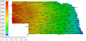
Nebraska (NE)

98,017 sq mi
Creative Commons License
Atlas Shading (with cities)
Medium resolution JPG 1259x601:
Preview | Download FREE
High resolution JPG 2828x1331:
Watermarked Preview | Add to Cart $0.99
Ultra resolution JPG 6753x3104:
Watermarked Preview | Add to Cart $1.99
Download the National Elevation Dataset

Select one of the options below if you would like to download the elevation data used to create this map.

30m GMG (202.6 MB) Preview | Add to cart $19.99
View Cart | Checkout

Select another state or map style
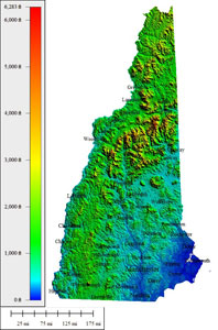
New Hampshire (NH)

18,076 sq mi
Creative Commons License
Atlas Shading (with cities)
Medium resolution JPG 616x931:
Preview | Download FREE
High resolution JPG 1681x2875:
Watermarked Preview | Add to Cart $0.99
Ultra resolution JPG 3954x7039:
Watermarked Preview | Add to Cart $1.99
Download the National Elevation Dataset

Select one of the options below if you would like to download the elevation data used to create this map.

30m GMG (29.1 MB) Preview | Add to cart $9.99
View Cart | Checkout

Select another state or map style
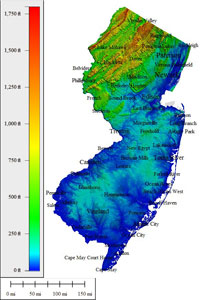
New Jersey (NJ)

16,097 sq mi
Creative Commons License
Atlas Shading (with cities)
Medium resolution JPG 595x876:
Preview | Download FREE
High resolution JPG 1513x2704:
Watermarked Preview | Add to Cart $0.99
Ultra resolution JPG 3539x6620:
Watermarked Preview | Add to Cart $1.99
Download the National Elevation Dataset

Select one of the options below if you would like to download the elevation data used to create this map.

30m GMG (17.9 MB) Preview | Add to cart $9.99
View Cart | Checkout

Select another state or map style
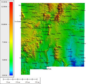
New Mexico (NM)

139,582 sq mi
Creative Commons License
Atlas Shading (with cities)
Medium resolution JPG 865x820:
Preview | Download FREE
High resolution JPG 2334x2504:
Watermarked Preview | Add to Cart $0.99
Ultra resolution JPG 5573x6122:
Watermarked Preview | Add to Cart $1.99
Download the National Elevation Dataset

Select one of the options below if you would like to download the elevation data used to create this map.

10m GMG (1.96 GB) Preview | Add to cart $24.99
30m GMG (303.4 MB) Preview | Add to cart $19.99
View Cart | Checkout

Select another state or map style
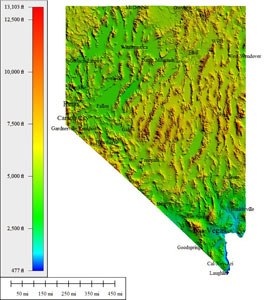
Nevada (NV)

163,065 sq mi
Creative Commons License
Atlas Shading (with cities)
Medium resolution JPG 752x855:
Preview | Download FREE
High resolution JPG 1951x2643:
Watermarked Preview | Add to Cart $0.99
Ultra resolution JPG 4635x6475:
Watermarked Preview | Add to Cart $1.99
Download the National Elevation Dataset

Select one of the options below if you would like to download the elevation data used to create this map.

30m GMG (310.7 MB) Preview | Add to cart $19.99
View Cart | Checkout

Select another state or map style
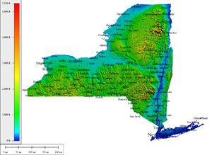
New York (NY)

131,120 sq mi
Creative Commons License
Atlas Shading (with cities)
Medium resolution JPG 1270x928:
Preview | Download FREE
High resolution JPG 2849x2146:
Watermarked Preview | Add to Cart $0.99
Ultra resolution JPG 6803x5177:
Watermarked Preview | Add to Cart $1.99
Download the National Elevation Dataset

Select one of the options below if you would like to download the elevation data used to create this map.

30m GMG (140.2 MB) Preview | Add to cart $19.99
View Cart | Checkout

Select another state or map style
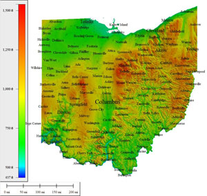
Ohio (OH)

64,418 sq mi
Creative Commons License
Atlas Shading (with cities)
Medium resolution JPG 950x899:
Preview | Download FREE
High resolution JPG 2635x2727:
Watermarked Preview | Add to Cart $0.99
Ultra resolution JPG 6291x6649:
Watermarked Preview | Add to Cart $1.99
Download the National Elevation Dataset

Select one of the options below if you would like to download the elevation data used to create this map.

30m GMG (106.1 MB) Preview | Add to cart $14.99
View Cart | Checkout

Select another state or map style
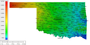
Oklahoma (OK)

125,166 sq mi
Creative Commons License
Atlas Shading (with cities)
Medium resolution JPG 1398x698:
Preview | Download FREE
High resolution JPG 2602x1284:
Watermarked Preview | Add to Cart $0.99
Ultra resolution JPG 6212x3053:
Watermarked Preview | Add to Cart $1.99
Download the National Elevation Dataset

Select one of the options below if you would like to download the elevation data used to create this map.

30m GMG (168.8 MB) Preview | Add to cart $19.99
View Cart | Checkout

Select another state or map style
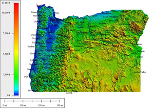
Oregon (OR)

124,505 sq mi
Creative Commons License
Atlas Shading (with cities)
Medium resolution JPG 1027x723:
Preview | Download FREE
High resolution JPG 2915x2118:
Watermarked Preview | Add to Cart $0.99
Ultra resolution JPG 6960x5099:
Watermarked Preview | Add to Cart $1.99
Download the National Elevation Dataset

Select one of the options below if you would like to download the elevation data used to create this map.

30m GMG (313.4 MB) Preview | Add to cart $19.99
View Cart | Checkout

Select another state or map style
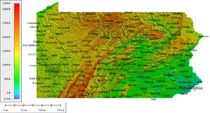
Pennsylvania (PA)

58,094 sq mi
Creative Commons License
Atlas Shading (with cities)
Medium resolution JPG 1254x675:
Preview | Download FREE
High resolution JPG 2816x1594:
Watermarked Preview | Add to Cart $0.99
Ultra resolution JPG 6723x3803:
Watermarked Preview | Add to Cart $1.99
Download the National Elevation Dataset

Select one of the options below if you would like to download the elevation data used to create this map.

30m GMG (136.5 MB) Preview | Add to cart $14.99
View Cart | Checkout

Select another state or map style
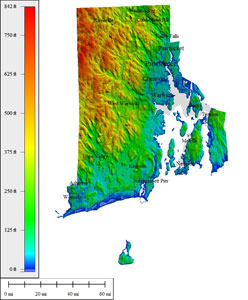
Rhode Island (RI)

2,818 sq mi
Creative Commons License
Atlas Shading (with cities)
Medium resolution JPG 742x896:
Preview | Download FREE
High resolution JPG 1982x2764:
Watermarked Preview | Add to Cart $0.99
Ultra resolution JPG 4712x6767:
Watermarked Preview | Add to Cart $1.99
Download the National Elevation Dataset

Select one of the options below if you would like to download the elevation data used to create this map.

30m GMG (3.3 MB) Preview | Add to cart $9.99
View Cart | Checkout

Select another state or map style
South Carolina (SC)

62,118 sq mi
Creative Commons License
Atlas Shading (with cities)
Medium resolution JPG 901x654:
Preview | Download FREE
High resolution JPG 2555x1947:
Watermarked Preview | Add to Cart $0.99
Ultra resolution JPG 6101x4716:
Watermarked Preview | Add to Cart $1.99
Download the National Elevation Dataset

Select one of the options below if you would like to download the elevation data used to create this map.

30m GMG (88.3 MB) Preview | Add to cart $14.99
View Cart | Checkout

Select another state or map style
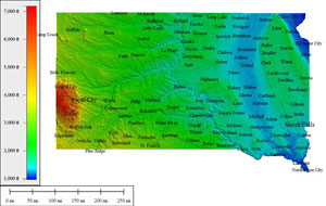
South Dakota (SD)

96,750 sq mi
Creative Commons License
Atlas Shading (with cities)
Medium resolution JPG 1036x657:
Preview | Download FREE
High resolution JPG 2938x1881:
Watermarked Preview | Add to Cart $0.99
Ultra resolution JPG 7015x4407:
Watermarked Preview | Add to Cart $1.99
Download the National Elevation Dataset

Select one of the options below if you would like to download the elevation data used to create this map.

30m GMG (200.9 MB) Preview | Add to cart $19.99
View Cart | Checkout

Select another state or map style
Tennessee (TN)

57,342 sq mi
Creative Commons License
Atlas Shading (with cities)
Medium resolution JPG 1421x401:
Preview | Download FREE
High resolution JPG 2644x695:
Watermarked Preview | Add to Cart $0.99
Ultra resolution JPG 6314x1577:
Watermarked Preview | Add to Cart $1.99
Download the National Elevation Dataset

Select one of the options below if you would like to download the elevation data used to create this map.

30m GMG (120.3 MB) Preview | Add to cart $14.99
View Cart | Checkout

Select another state or map style
Texas (TX)

600,862 sq mi
Creative Commons License
Atlas Shading (with cities)
Medium resolution JPG 849x722:
Preview | Download FREE
High resolution JPG 2407x2198:
Watermarked Preview | Add to Cart $0.99
Ultra resolution JPG 5748x5360:
Watermarked Preview | Add to Cart $1.99
Download the National Elevation Dataset

Select one of the options below if you would like to download the elevation data used to create this map.

30m GMG (995 MB) Preview | Add to cart $24.99
View Cart | Checkout

Select another state or map style
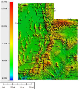
Utah (UT)

100,045 sq mi
Creative Commons License
Atlas Shading (with cities)
Medium resolution JPG 785x870:
Preview | Download FREE
High resolution JPG 2186x2680:
Watermarked Preview | Add to Cart $0.99
Ultra resolution JPG 5210x6562:
Watermarked Preview | Add to Cart $1.99
Download the National Elevation Dataset

Select one of the options below if you would like to download the elevation data used to create this map.

30m GMG (244.4 MB) Preview | Add to cart $19.99
View Cart | Checkout

Select another state or map style
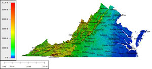
Virginia (VA)

94,898 sq mi
Creative Commons License
Atlas Shading (with cities)
Medium resolution JPG 1200x547:
Preview | Download FREE
High resolution JPG 2697x1201:
Watermarked Preview | Add to Cart $0.99
Ultra resolution JPG 6439x2834:
Watermarked Preview | Add to Cart $1.99
Download the National Elevation Dataset

Select one of the options below if you would like to download the elevation data used to create this map.

30m GMG (117.5 MB) Preview | Add to cart $19.99
View Cart | Checkout

Select another state or map style
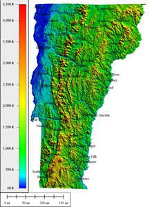
Vermont (VT)

15,823 sq mi
Creative Commons License
Atlas Shading (with cities)
Medium resolution JPG 680x929:
Preview | Download FREE
High resolution JPG 1889x2869:
Watermarked Preview | Add to Cart $0.99
Ultra resolution JPG 4478x7024:
Watermarked Preview | Add to Cart $1.99
Download the National Elevation Dataset

Select one of the options below if you would like to download the elevation data used to create this map.

30m GMG (31.4 MB) Preview | Add to cart $9.99
View Cart | Checkout

Select another state or map style
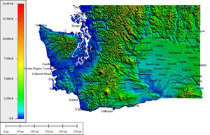
Washington (WA)

93,010 sq mi
Creative Commons License
Atlas Shading (with cities)
Medium resolution JPG 1090x700:
Preview | Download FREE
High resolution JPG 3097x1994:
Watermarked Preview | Add to Cart $0.99
Ultra resolution JPG 7394x4764:
Watermarked Preview | Add to Cart $1.99
Download the National Elevation Dataset

Select one of the options below if you would like to download the elevation data used to create this map.

30m GMG (238.9 MB) Preview | Add to cart $19.99
View Cart | Checkout

Select another state or map style
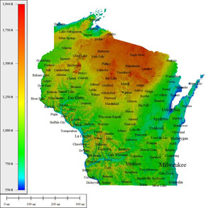
Wisconsin (WI)

106,799 sq mi
Creative Commons License
Atlas Shading (with cities)
Medium resolution JPG 998x974:
Preview | Download FREE
High resolution JPG 2916x2949:
Watermarked Preview | Add to Cart $0.99
Ultra resolution JPG 6962x7172:
Watermarked Preview | Add to Cart $1.99
Download the National Elevation Dataset

Select one of the options below if you would like to download the elevation data used to create this map.

30m GMG (242.4 MB) Preview | Add to cart $19.99
View Cart | Checkout

Select another state or map style
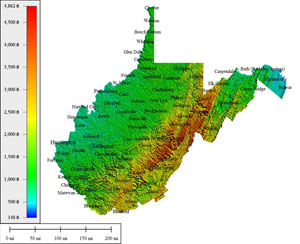
West Virginia (WV)

65,069 sq mi
Creative Commons License
Atlas Shading (with cities)
Medium resolution JPG 958x780:
Preview | Download FREE
High resolution JPG 2720x2335:
Watermarked Preview | Add to Cart $0.99
Ultra resolution JPG 6493x5740:
Watermarked Preview | Add to Cart $1.99
Download the National Elevation Dataset

Select one of the options below if you would like to download the elevation data used to create this map.

30m GMG (84.7 MB) Preview | Add to cart $14.99
View Cart | Checkout

Select another state or map style
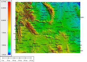
Wyoming (WY)

108,284 sq mi
Creative Commons License
Atlas Shading (with cities)
Medium resolution JPG 1012x715:
Preview | Download FREE
High resolution JPG 2870x2227:
Watermarked Preview | Add to Cart $0.99
Ultra resolution JPG 6853x5229:
Watermarked Preview | Add to Cart $1.99
Download the National Elevation Dataset

Select one of the options below if you would like to download the elevation data used to create this map.

10m GMG (1.84 GB) Preview | Add to cart $24.99
30m GMG (290 MB) Preview | Add to cart $19.99
View Cart | Checkout

Select another state or map style

TERMS OF USE

All maps displayed on this page or downloadable via a "download" link on this page are © 2009 topocreator.com released to the public under a Creative Commons Attribution-Share Alike license. Maps are available for purchase for a small fee for educational, personal, and commercial usage under an alternative license. The elevation data used in the creation of these maps has been obtained through the USGS, NOAA, and the US Census Bureau via the public domain.