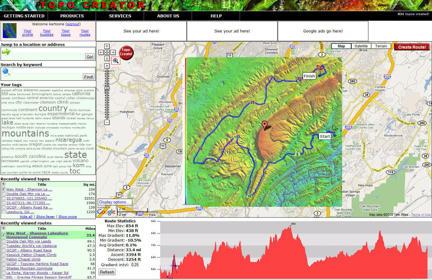
Home » State maps and elevation data
Terms of use. All maps displayed on this page or downloadable via a "download" link on this page are © 2009 topocreator.com released to the public under a Creative Commons Attribution-Share Alike license. Maps are available for purchase for a small fee for educational, personal, and commercial usage under an alternative license. The elevation data used in the creation of these maps has been obtained through the USGS, NOAA, and the US Census Bureau via the public domain.
Alaska (AK)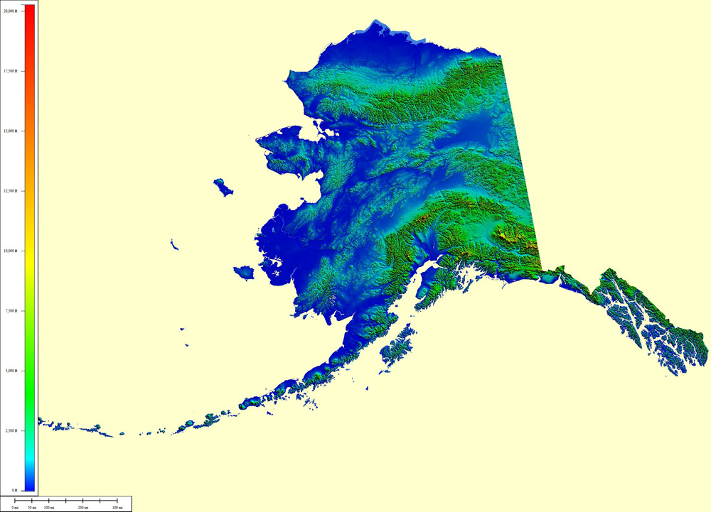 2,833,084 sq mi  |
|
|||||||
| Select another state or map style | ||||||||
Alabama (AL)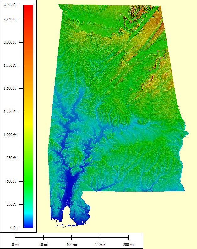 75,032 sq mi |
|
|||||||
| Select another state or map style | ||||||||
Arkansas (AR)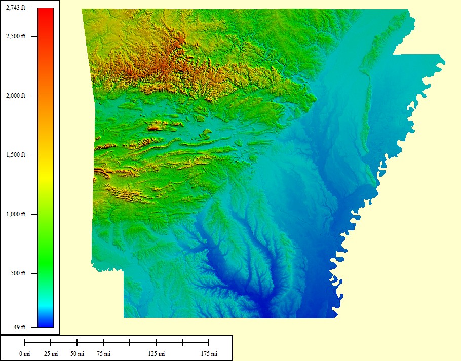 69,493 sq mi |
|
|||||||
| Select another state or map style | ||||||||
Arizona (AZ)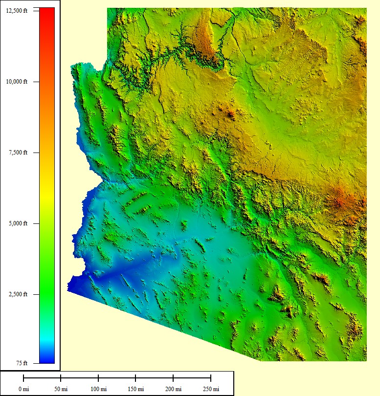 133,291 sq mi |
|
|||||||
| Select another state or map style | ||||||||
California (CA)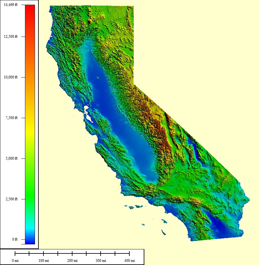 393,043 sq mi |
|
|||||||
| Select another state or map style | ||||||||
Colorado (CO) 118,740 sq mi |
|
|||||||
| Select another state or map style | ||||||||
Connecticut (CT)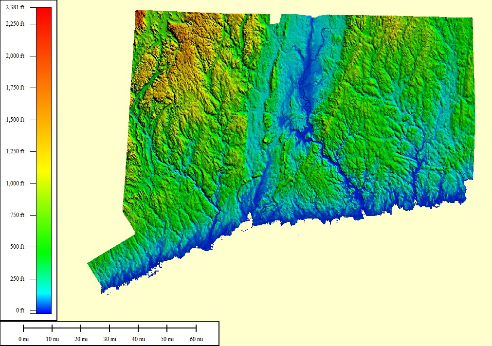 7,969 sq mi |
|
|||||||
| Select another state or map style | ||||||||
District of Columbia (DC)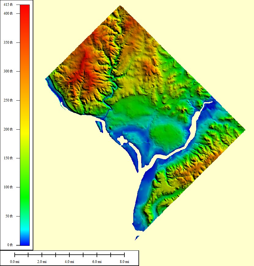 167 sq mi |
|
|||||||
| Select another state or map style | ||||||||
Delaware (DE)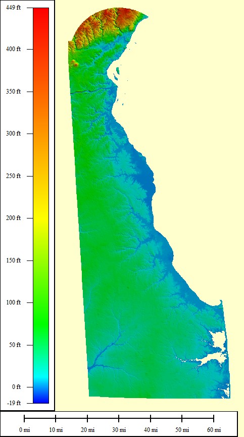 5,045 sq mi |
|
|||||||
| Select another state or map style | ||||||||
Florida (FL)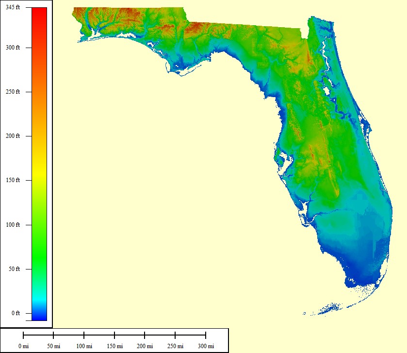 221,869 sq mi |
|
|||||||
| Select another state or map style | ||||||||
Georgia (GA)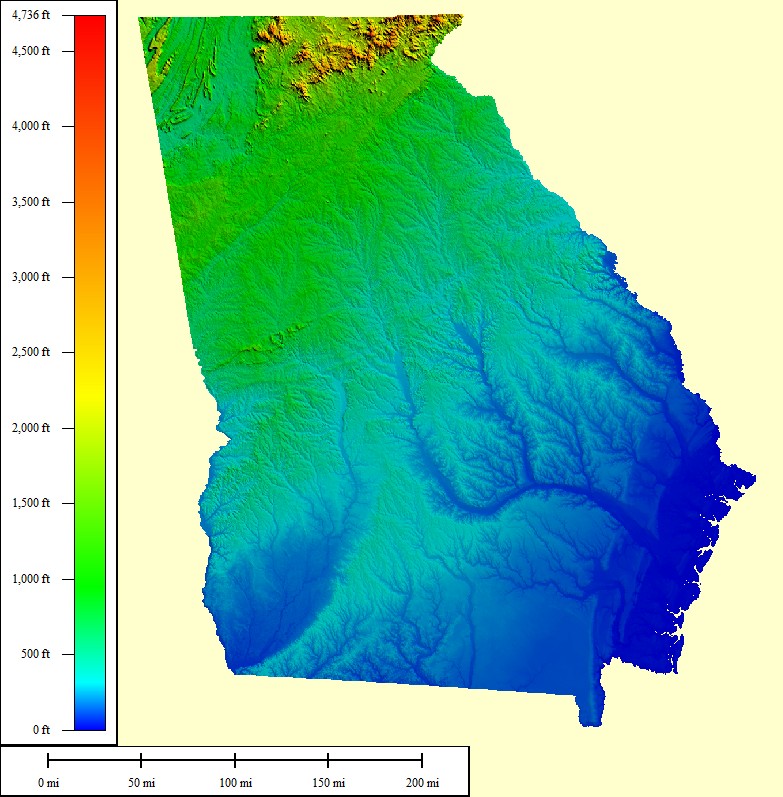 92,786 sq mi |
|
|||||||
| Select another state or map style | ||||||||
Hawaii (HI)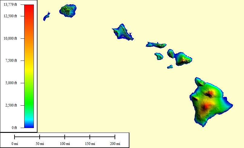 86,232 sq mi |
|
|||||||
| Select another state or map style | ||||||||
Iowa (IA)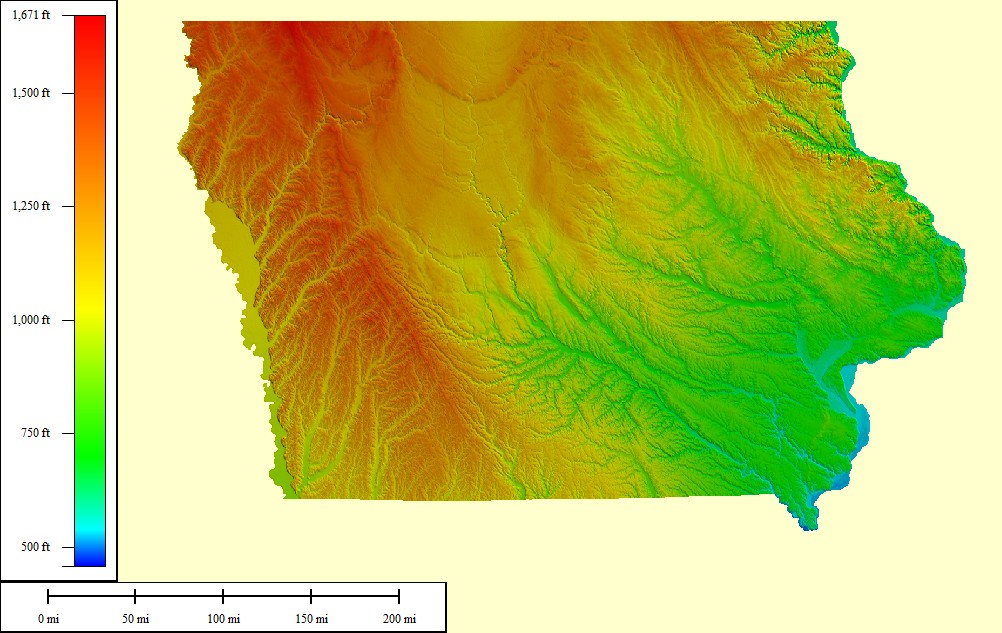 75,412 sq mi |
|
|||||||
| Select another state or map style | ||||||||
Idaho (ID)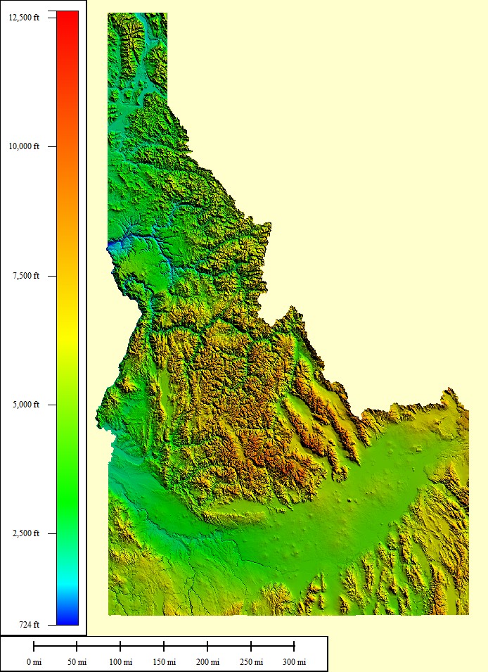 154,028 sq mi |
|
|||||||
| Select another state or map style | ||||||||
Illinois (IL)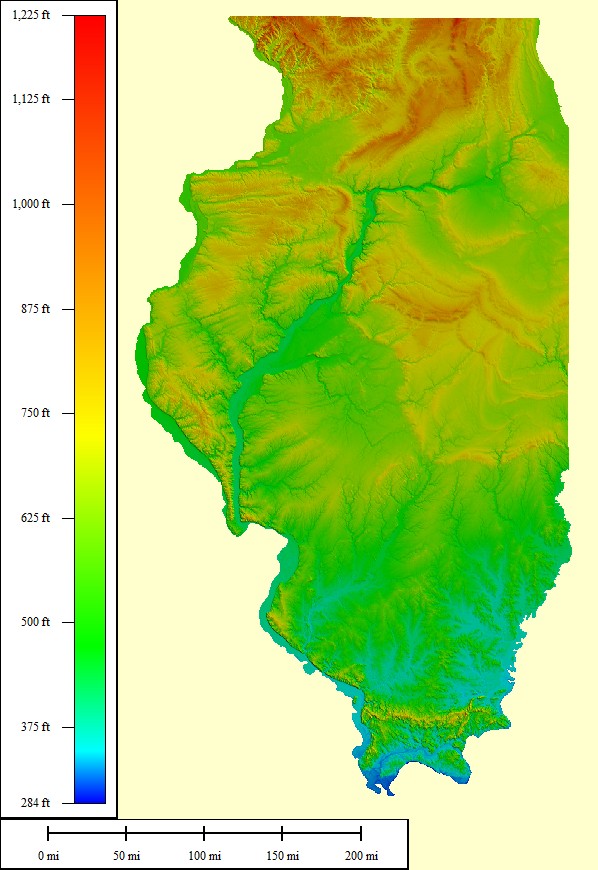 95,503 sq mi |
|
|||||||
| Select another state or map style | ||||||||
Indiana (IN)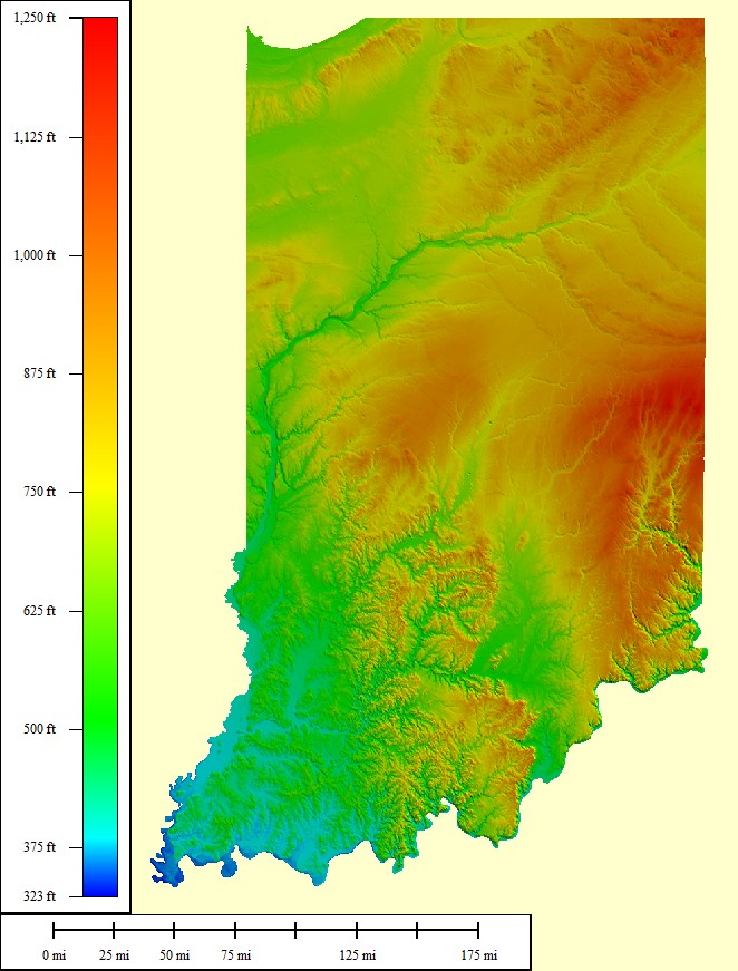 57,317 sq mi |
|
|||||||
| Select another state or map style | ||||||||
Kansas (KS)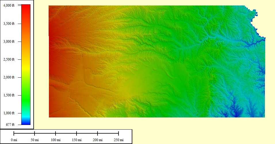 85,498 sq mi |
|
|||||||
| Select another state or map style | ||||||||
Kentucky (KY)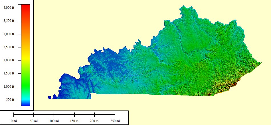 77,240 sq mi |
|
|||||||
| Select another state or map style | ||||||||
Louisiana (LA)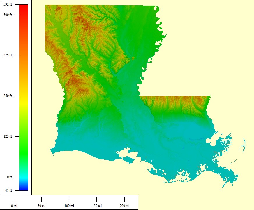 89,981 sq mi |
|
|||||||
| Select another state or map style | ||||||||
Massachussetts (MA)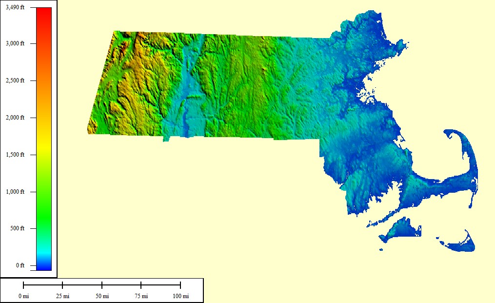 22,149 sq mi |
|
|||||||
| Select another state or map style | ||||||||
Maryland (MD) 30,920 sq mi |
|
|||||||
| Select another state or map style | ||||||||
Maine (ME)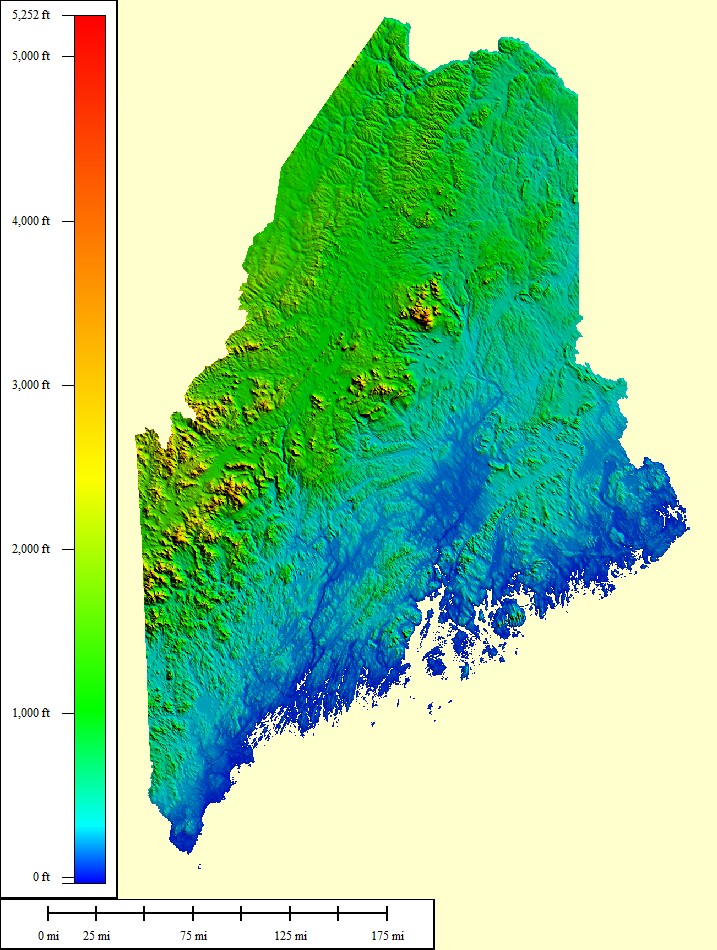 65,426 sq mi |
|
|||||||
| Select another state or map style | ||||||||
Michigan (MI)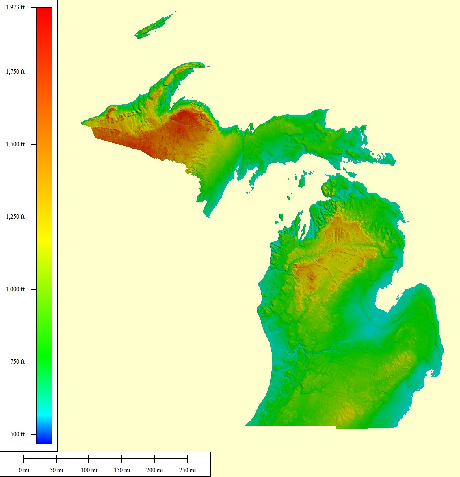 197,037 sq mi |
|
|||||||
| Select another state or map style | ||||||||
Minnesota (MN)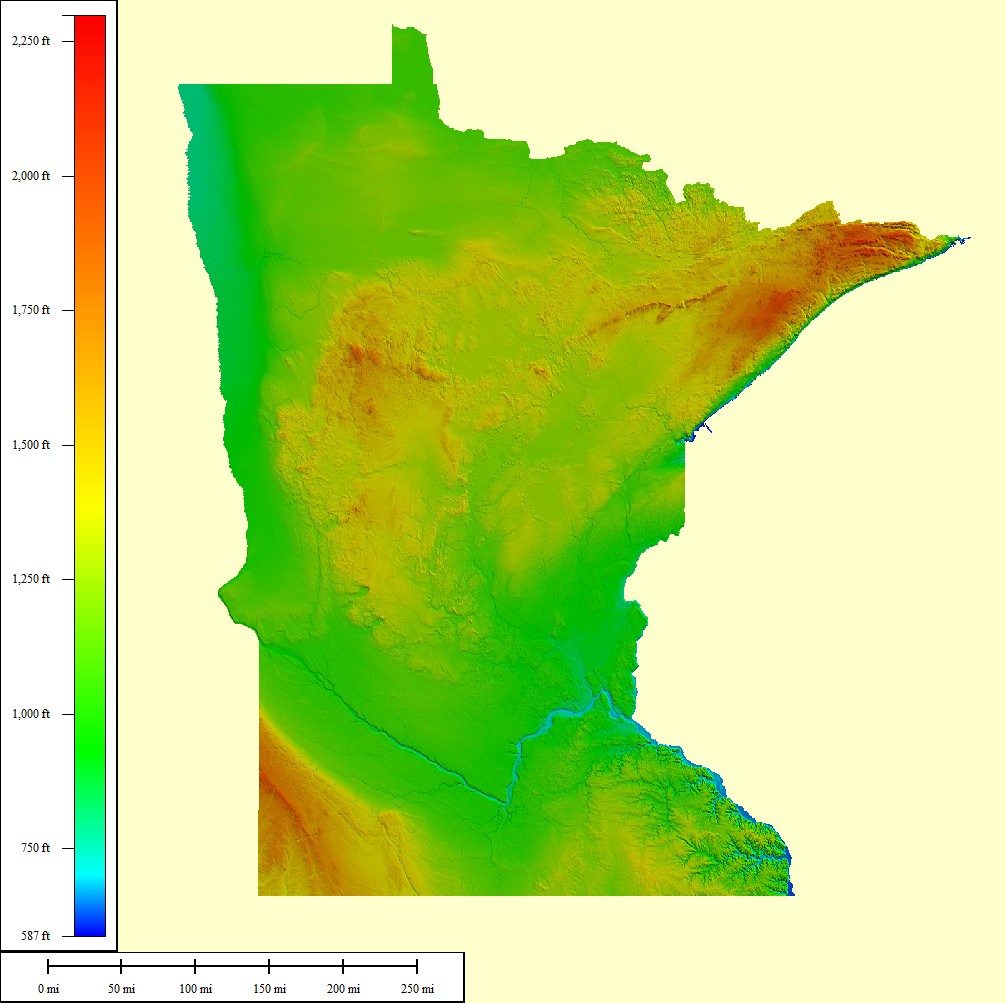 157,760 sq mi |
|
|||||||
| Select another state or map style | ||||||||
Missouri (MO)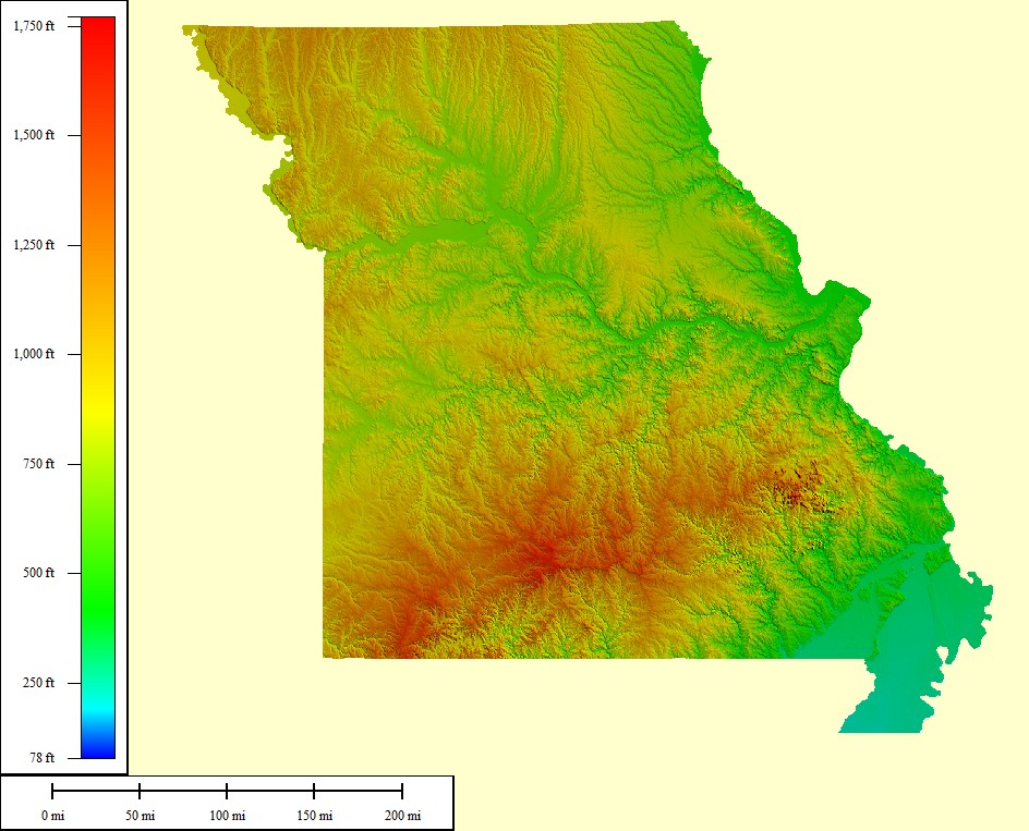 120,485 sq mi |
|
|||||||
| Select another state or map style | ||||||||
Mississippi (MS)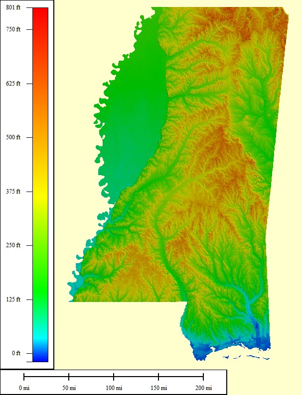 76,655 sq mi |
|
|||||||
| Select another state or map style | ||||||||
Montana (MT)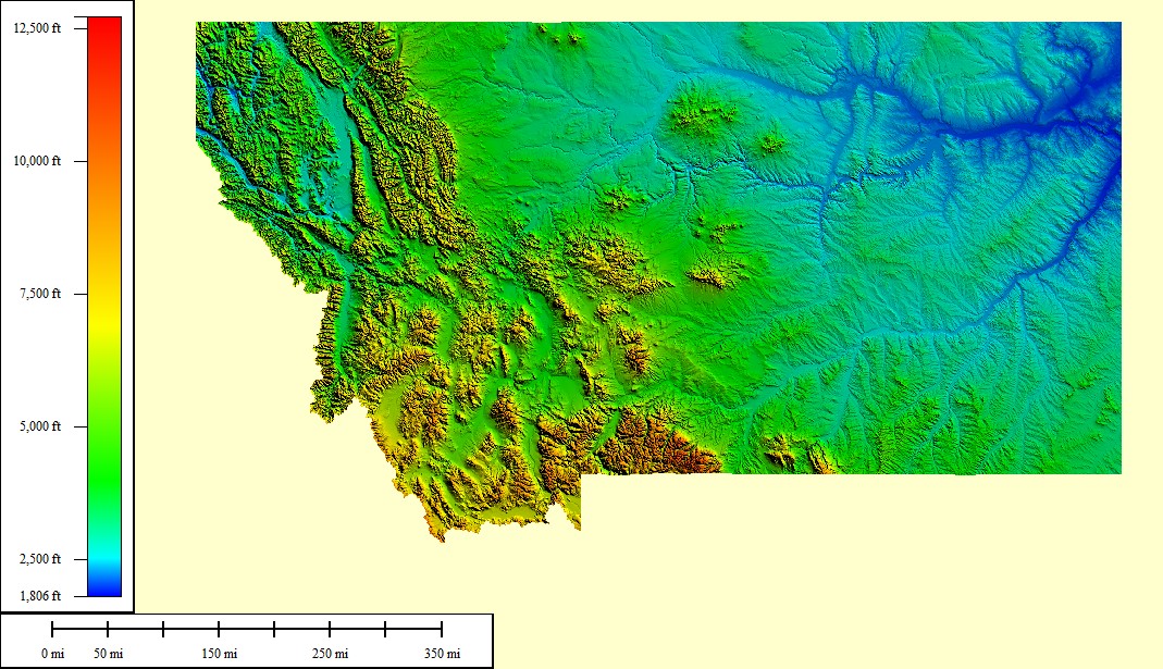 218,830 sq mi |
|
|||||||
| Select another state or map style | ||||||||
North Carolina (NC)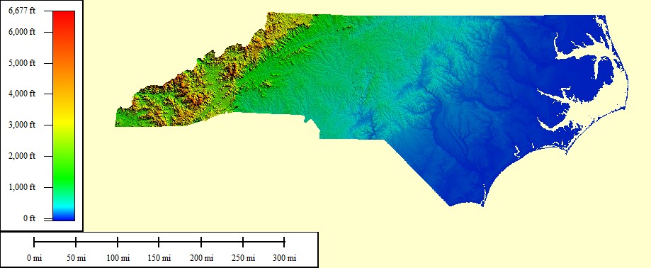 96,798 sq mi |
|
|||||||
| Select another state or map style | ||||||||
North Dakota (ND)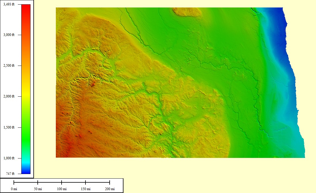 77,387 sq mi |
|
|||||||
| Select another state or map style | ||||||||
Nebraska (NE)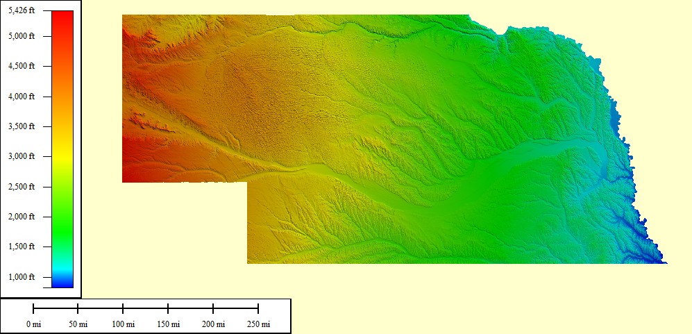 98,017 sq mi |
|
|||||||
| Select another state or map style | ||||||||
New Hampshire (NH)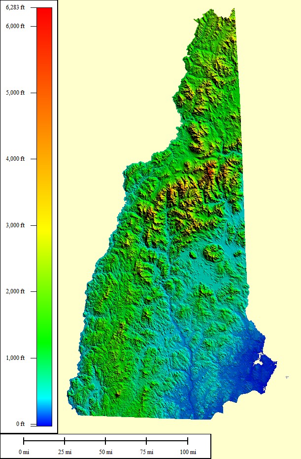 18,076 sq mi |
|
|||||||
| Select another state or map style | ||||||||
New Jersey (NJ)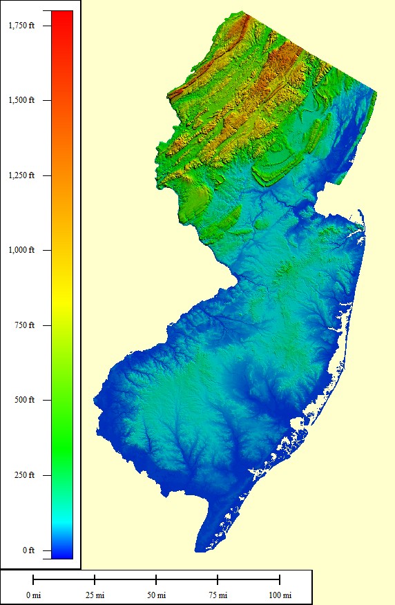 16,097 sq mi |
|
|||||||
| Select another state or map style | ||||||||
New Mexico (NM)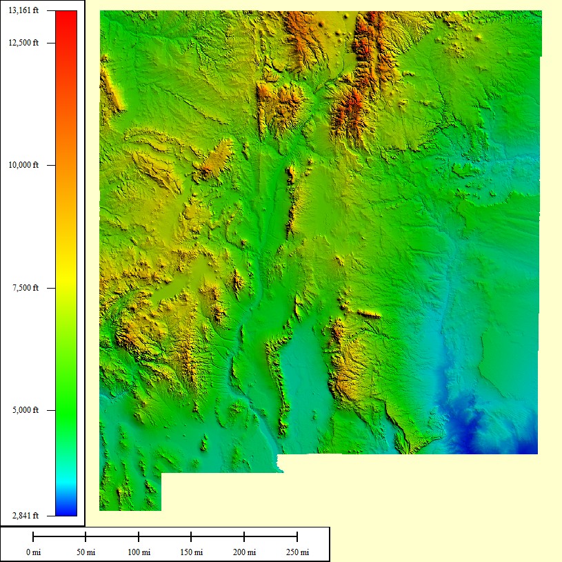 139,582 sq mi |
|
|||||||
| Select another state or map style | ||||||||
Nevada (NV)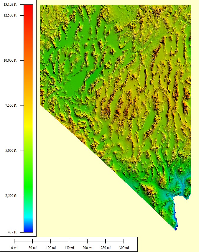 163,065 sq mi |
|
|||||||
| Select another state or map style | ||||||||
New York (NY)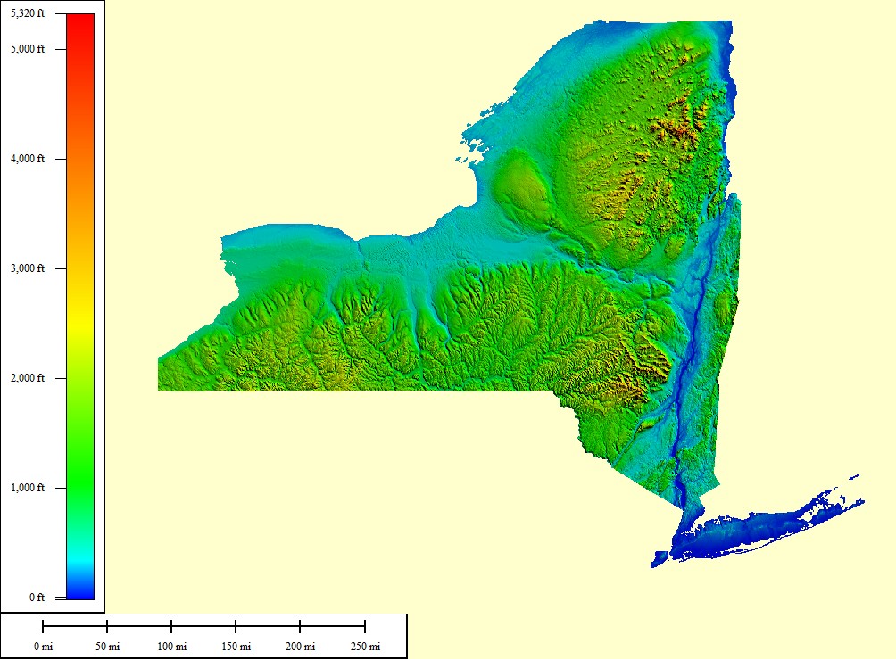 131,120 sq mi |
|
|||||||
| Select another state or map style | ||||||||
Ohio (OH)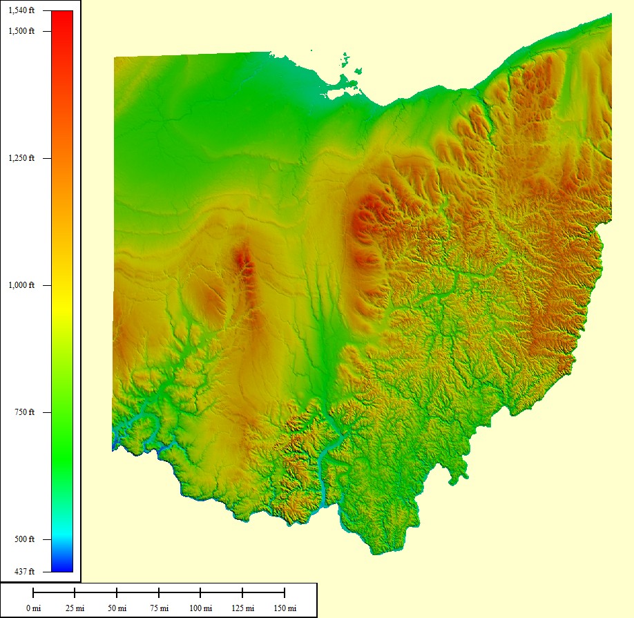 64,418 sq mi |
|
|||||||
| Select another state or map style | ||||||||
Oklahoma (OK)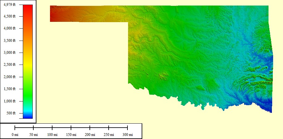 125,166 sq mi |
|
|||||||
| Select another state or map style | ||||||||
Oregon (OR)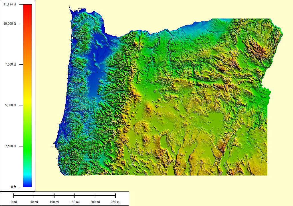 124,505 sq mi |
|
|||||||
| Select another state or map style | ||||||||
Pennsylvania (PA)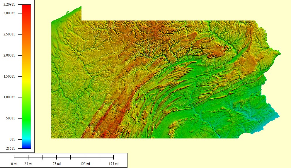 58,094 sq mi |
|
|||||||
| Select another state or map style | ||||||||
Rhode Island (RI)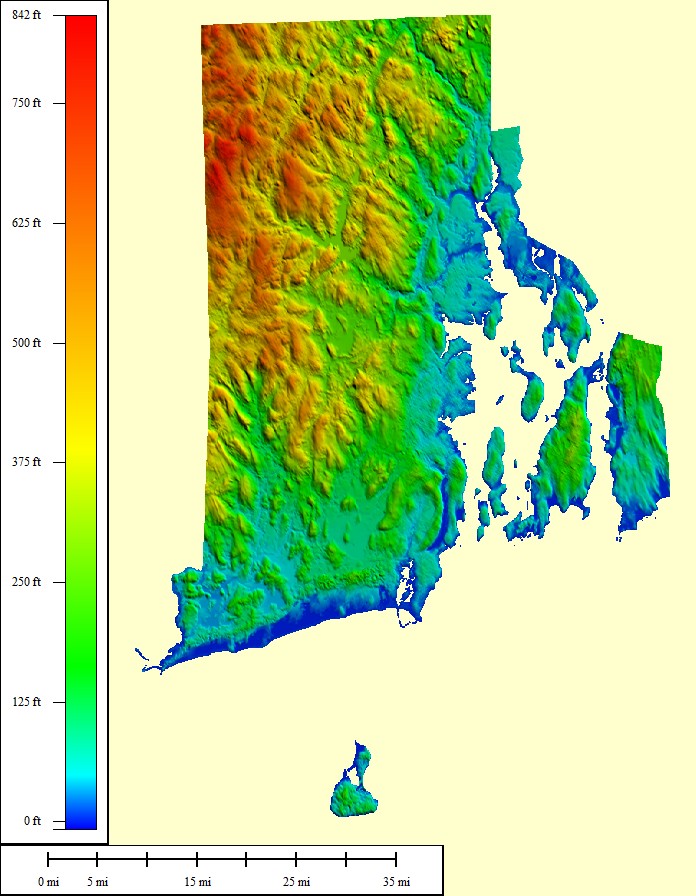 2,818 sq mi |
|
|||||||
| Select another state or map style | ||||||||
South Carolina (SC)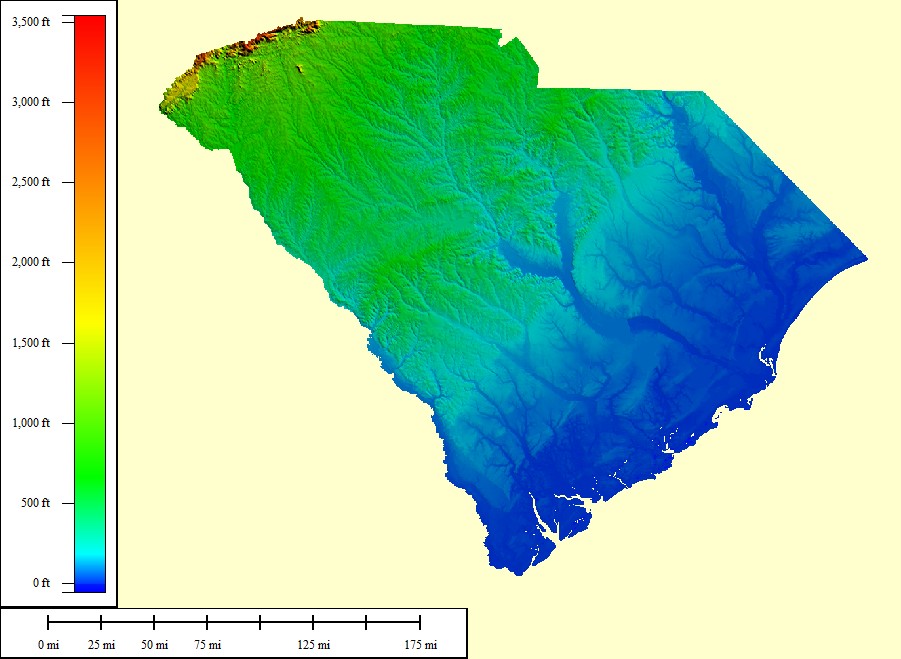 62,118 sq mi |
|
|||||||
| Select another state or map style | ||||||||
South Dakota (SD)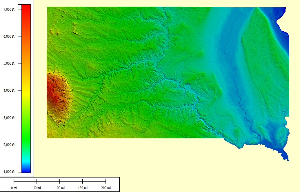 96,750 sq mi |
|
|||||||
| Select another state or map style | ||||||||
Tennessee (TN)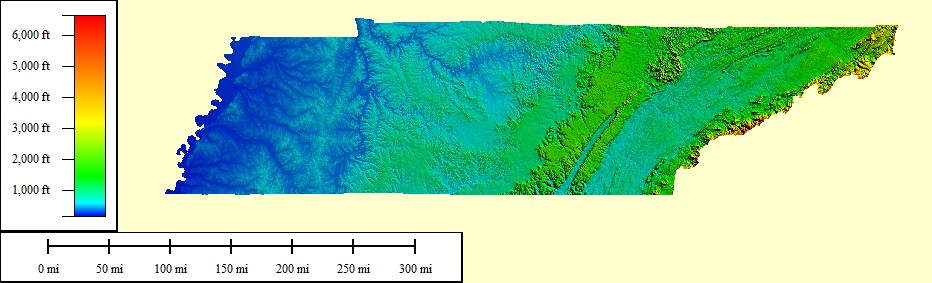 57,342 sq mi |
|
|||||||
| Select another state or map style | ||||||||
Texas (TX)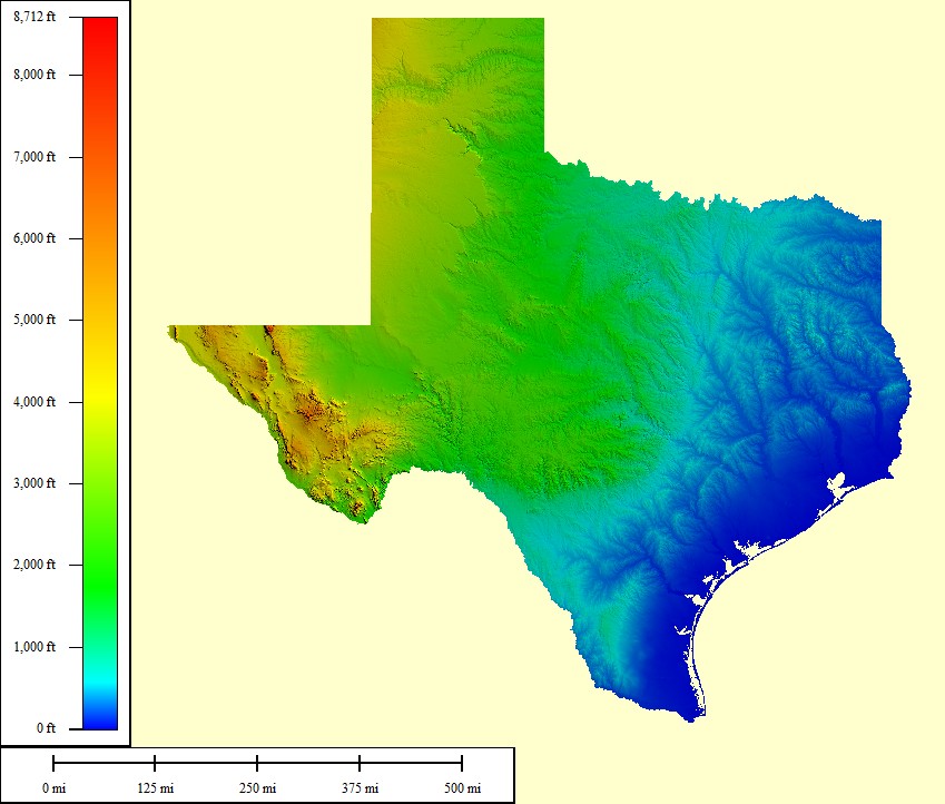 600,862 sq mi |
|
|||||||
| Select another state or map style | ||||||||
Utah (UT)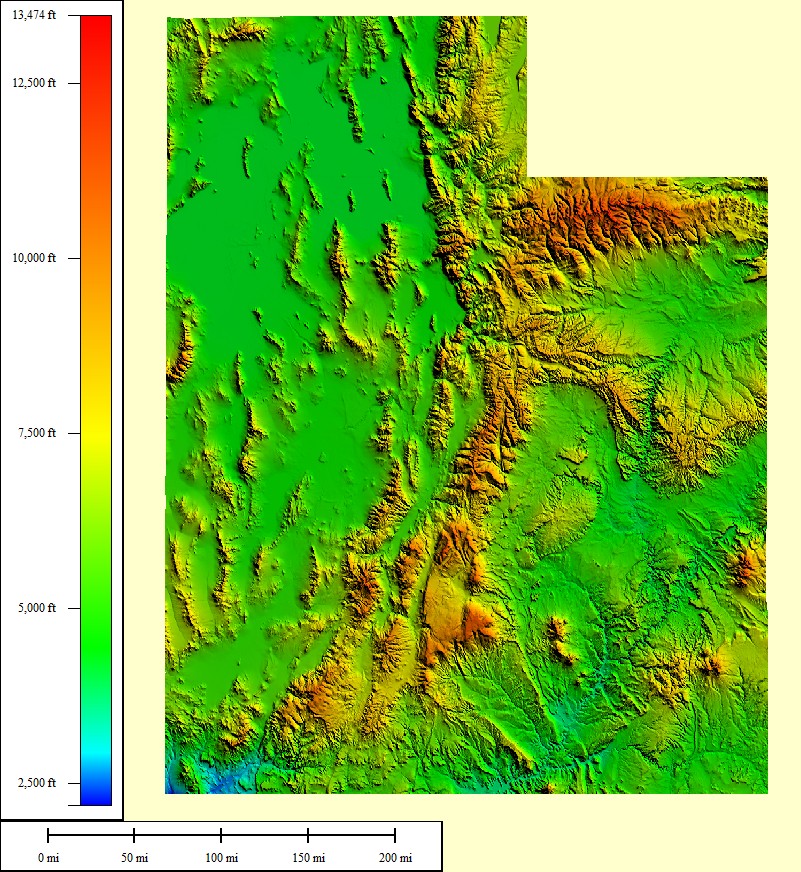 100,045 sq mi |
|
|||||||
| Select another state or map style | ||||||||
Virginia (VA)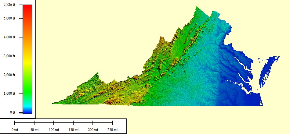 94,898 sq mi |
|
|||||||
| Select another state or map style | ||||||||
Vermont (VT) 15,823 sq mi |
|
|||||||
| Select another state or map style | ||||||||
Washington (WA)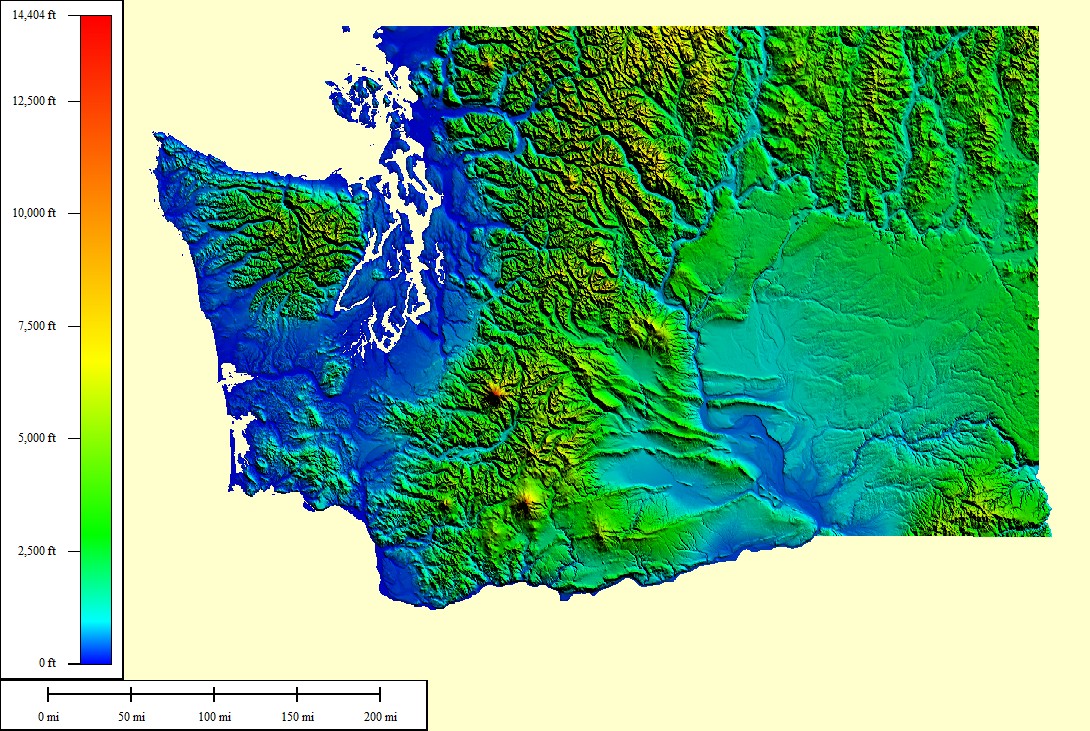 93,010 sq mi |
|
|||||||
| Select another state or map style | ||||||||
Wisconsin (WI)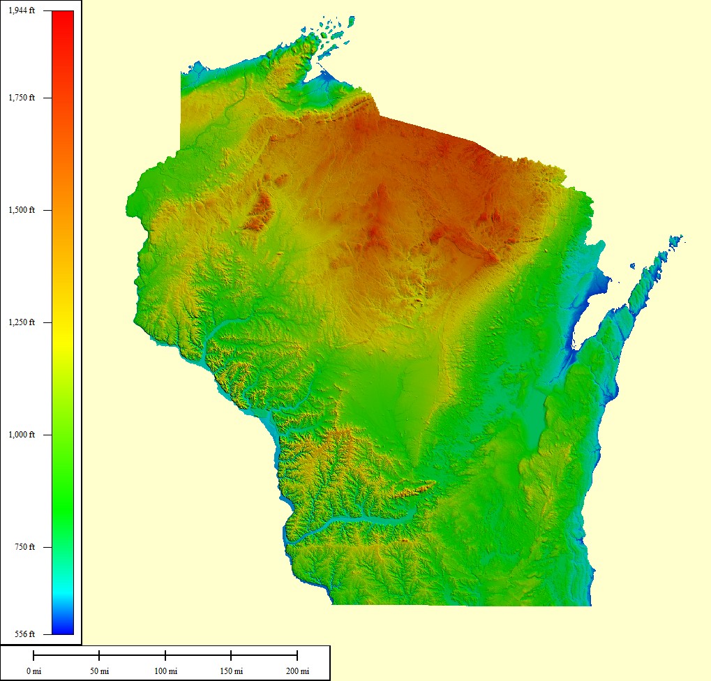 106,799 sq mi |
|
|||||||
| Select another state or map style | ||||||||
West Virginia (WV)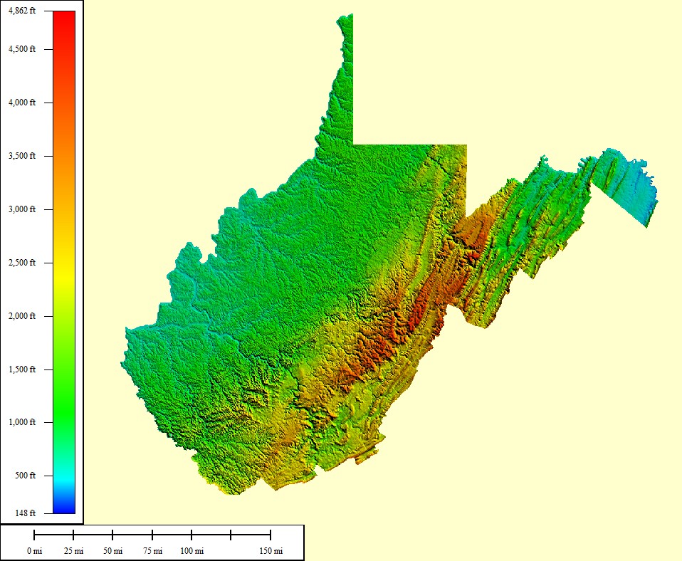 65,069 sq mi |
|
|||||||
| Select another state or map style | ||||||||
Wyoming (WY)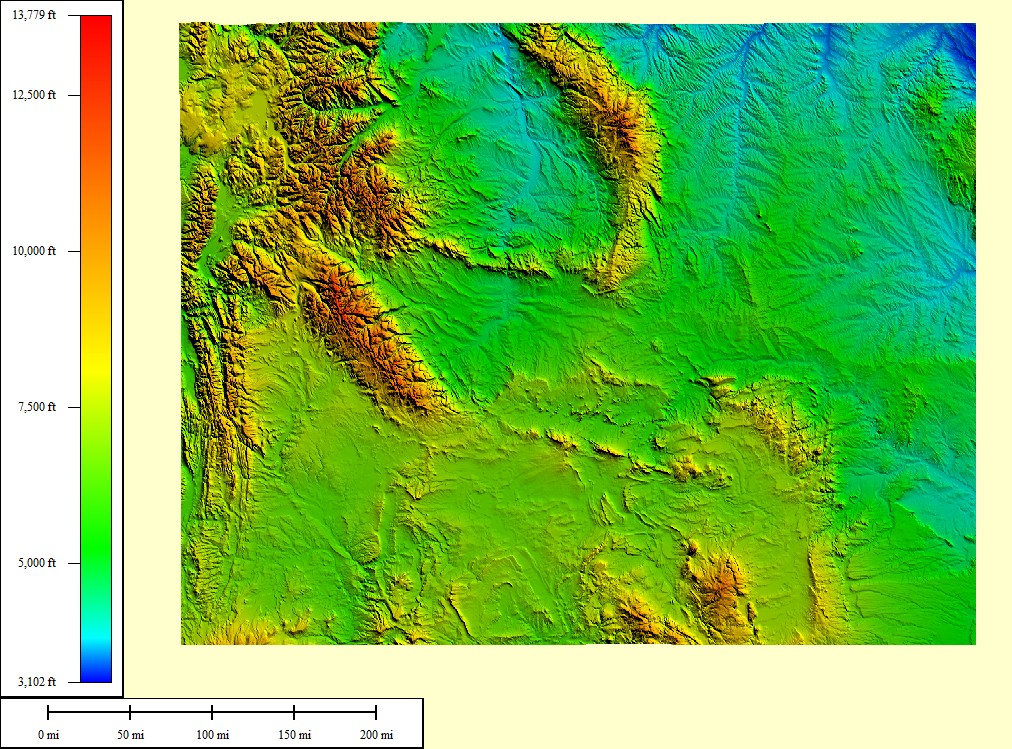 108,284 sq mi |
|
|||||||
| Select another state or map style | ||||||||


TERMS OF USE
All maps displayed on this page or downloadable via a "download" link on this page are © 2009 topocreator.com released to the public under a Creative Commons Attribution-Share Alike license. Maps are available for purchase for a small fee for educational, personal, and commercial usage under an alternative license. The elevation data used in the creation of these maps has been obtained through the USGS, NOAA, and the US Census Bureau via the public domain.